

The CoMaps project, which is developing a fully open community fork of the mobile mapping application Organic Maps, has released its update on 2026-05-06 along with a yearly development report. The CoMaps code is distributed under the Apache 2.0 license. The app is available in F-Droid, Google Play, Apple App Store, Flathub, and also directly on Codeberg.
The main innovation in this release is the ability to update maps independently of the app itself, using the new 'Check for Updates' button on the map loading screen. Historically, app and map versions have been closely tied — access to new maps required updating the app first. This simplified compatibility maintenance but necessitated constant app updates and often long waits for app store approval of each release — each day of waiting made the maps less current. Fresh maps are now planned to be released weekly, and their relevance at the time of release will last only a couple of days. Currently, maps based on OpenStreetMap data from May 10 are available for download.
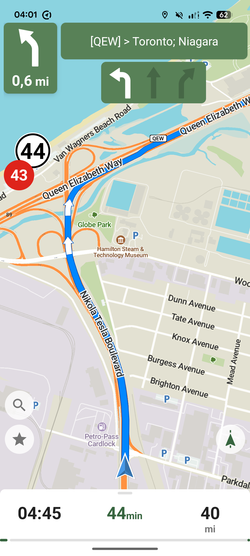
Additionally, the new version now displays only traffic lights on the route during navigation, but with larger icons. In the Android version, search categories are now shown in columns, and an incognito mode setting for the system keyboard has been implemented. In the iOS version, a start recording track button has been added to the navigation mode toolbar.
On May 12, the project turned one year old, during which about 100 people made 2500 commits to the main project repository on Codeberg. More than 270 translators are working on translations into 80 languages (30 of which are already fully ready). One of the main English-speaking Matrix/Telegram chats has over 1200 participants. There are also chats in Spanish, French, German, Turkish, and Russian. Current operational issues are typically discussed by developers in the CoMaps space on the Zulip platform, which features about 50 active participants. The user base of the project across all platforms is estimated to be around 250,000 people.
Among other notable changes over the year:
- Expanded information about points of interest (POI): links to panoramas from 'Panoramax', display of the date of the last update for the object, availability of organic options in shops and cafes, information on service costs, detailed information about electric vehicle charging (type, power, number of ports, etc.).
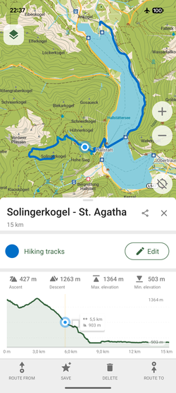
- Route building: taking into account additional time for crossing intersections, traffic lights, and stop signs; consideration of temporary/conditional restrictions; options to avoid steps and cobblestone roads (for adventure lovers).
- Around 100 new types of different objects have been added to the map, and significant work has been done to improve the overall style of map display, including the 'Active Recreation' style.
- Wikipedia articles about map objects are now available in 17 languages (originally there were 5).
- Work has been done to ensure privacy and modernize the code.
- Starting December 2025, the Android version of CoMaps will allow the use of third-party/own servers with maps. The 'official' network has been expanded. servers, many of which are provided and supported by community members.
- Various open improvements from the Organic Maps project have been integrated (some of the new capabilities of OM are based on proprietary code changes of the map generator and require rework to be included in CoMaps).
- Efforts have been made to improve the built-in OpenStreetMap editor in CoMaps, for example, the ability to create objects that require multiple OSM tags, the option to mark objects as unused, simplified note addition, etc. Over the past year, more than 7,500 CoMaps users have used the built-in editor, making nearly 90,000 changes to OpenStreetMap. This includes a couple of notes with ideas on how to find and fix notes created in CoMaps and how to find and correct errors in OSM data.
- CoMaps was selected as the default map for iodéOS and CalyxOS. * The 'European & Open Source Alternatives' project rated CoMaps with a trust score of 9.6 out of 10 — the highest rating among navigation applications. The Switching Software resource recommended CoMaps as an alternative to Google Maps. The 'is it really foss?' project confirmed that CoMaps is a completely open project with no caveats or hidden traps.
Future plans include integrating up-to-date traffic information, improvements related to public transport, adding user reviews/ratings, and creating specialized map styles for various types of transport.
The CoMaps project was founded by former volunteer contributors of Organic Maps, dissatisfied with Organic Maps' reliance on the interests of shareholders of the commercial company, the lack of transparency in the management process, obscure distribution of donations, and inconsistency with the proclaimed principles of open-source. The fork is developed according to the principles of openness, transparency, and collaboration. The project focuses solely on non-profit activities and accountability to the community. Key principles for app development include a simple user interface, offline functionality, lightweight design (including energy consumption), and no ads, identity collection, or data gathering. 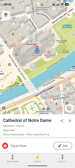
Source: opennet.ru
