

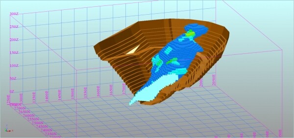
In today's world, the use of software for modeling deposits and mining operations is no longer extraordinary. There is a sufficient number of software products in the market that, depending on the manufacturer’s modifications, cover almost all needs related to the mining and geological conditions of enterprises and the processes performed by mining engineers, geologists, and surveyors.
The unique characteristics of this industry in Russia, evident to professionals working here, differ somewhat from the principles that foreign companies—the main producers of mining geological software (hereinafter GIS—geoinformation systems) operate under, which are currently offered in the domestic market.
The reality in Russia is such that enterprises need GIS that are adapted to the conditions in which they have long been accustomed to working. It is also important to note that there are no identical deposits in nature, and therefore, each mining enterprise is unique with its individual features and nuances in the engineering support of mining operations.
Examples of such distinguishing features include the type of mineral resource and its morphology, methods and systems of deposit development, and the technology for enriching the mineral resource, which create exceptional working conditions that differentiate enterprises from one another.
It is crucial that the information technologies imposed on the engineering staff do not disrupt the established production and technological processes performed by specialists, which is inevitable with the thoughtless imposition of external GIS in its original format. Changing the established workflow of specialists may, at best, lead to their aversion to the new software, and at worst, kill the new technology in its infancy, even before it is fully implemented.
Years of experience in sales and implementation of various software GEOVIA It can be unequivocally stated that foreign GIS in their basic configuration do not meet the needs of Russian engineers in solving their everyday tasks. This assertion is supported by the fact that Russian users regularly request functionalities that go beyond the understanding of foreign developers about the needs of our market. This holds true for all software products in demand in Russia, including software of Russian origin, which typically undergoes further modifications and refinements by the producer to meet the needs of an enterprise during its operation. This creates an illusion that Russian packages fully address the requirements of our market, which often does not correspond to reality.
Generally, GIS in standard configuration consists of a set of specific elemental specialized tools, the proper use of which allows for the resolution of quite complex tasks. In this case, the final result can be achieved in several steps or by simply pressing one or two buttons.
Of all the existing options to achieve a goal, the most interesting for the user is always the one that requires the minimum resources (time-money-people). Among the products, GEOVIA the product that has integrated most harmoniously into the Russian market is .
According to our observations, the most significant arguments for its selection are the localization of the package, a user-friendly interface, and the ability to adapt the product to the individual needs of the user.
The concept proposed by the developers of Surpac for adapting the program to the needs of enterprises allows users to independently write and develop the software product using the widely used TCL language, tailoring the program to their specific tasks.
Furthermore, when using Surpac software, the lacking functionalities, referred to as "buttons," can be logically and mathematically described using the aforementioned programming language. The "buttons" created in this manner can then be used as additional tools for engineers.
It is no secret that no software operates in isolation. This applies both to complex engineering software and to the most straightforward office applications.
Effective use of GIS is impossible without the involvement of interested specialists with an adequate level of qualification. Thanks to the engineering ingenuity and creative approach of specialists using the TCL language directly on-site, enterprises have the chance to obtain a set of 'buttons' for executing specific logically coherent everyday operations that are performed regularly by the company's staff.
Experience using Surpac in the industry has shown that passionate and engaged specialists can modify the program to suit their needs, changing it to such an extent that its functionality and interface become barely recognizable.
Over several years of work, specialists from the Russian division GEOVIA have accumulated experience in successfully solving automation tasks for routine processes and implementing a number of specific algorithms.
Currently, the most vulnerable part of most mining and geological software packages is their inability to ensure compliance with the regulations governing surveying work. In most cases, when any software is used at an enterprise, surveying services are forced to supplement the mandatory mining and graphic documentation both in electronic form and on standard hard paper carriers, effectively performing double work. This does not add positivity for users regarding the software.
To achieve compliance with regulatory documents (with the participation of clients), specialists from the Russian division of GEOVIA developed specialized modules and tools for maintaining surveying tablets and longitudinal/transversal sections in the format accepted by the enterprise and in accordance with specific norms and rules.
The new functionality allows for printing information on paper carriers at defined intervals, as stated in the relevant section of the instructions for conducting surveying work.
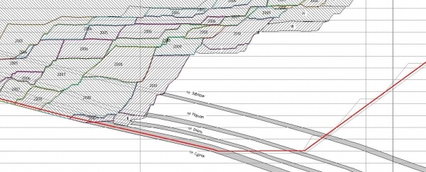
Surveying section
A substantial portion of time in surveying work is dedicated to ensuring drilling and blasting operations, which includes issuing bases for the design of drilling wells, surveying actual wells, analyzing compliance with the drilling plan, closing drilling volumes, and the volume of blasted rock mass.
At the request of the Client, a specialized accounting module for drilling and blasting operations was developed, utilizing an external database for design and actual drilling wells, the application of which not only allows for the execution of all necessary tasks in a shorter time frame without using traditional tools and consumables (ink and pen) but also ensures that the output results comply with current norms and regulations. This module is currently successfully used at two Russian enterprises.
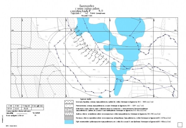
Extraction from the mining work plan for the design of drilling and blasting operations
Specifically for geological services involved in updating geological data and ore preparation, work was carried out to set tasks, write algorithms, and implement a set of tools that harmoniously combine modern three-dimensional modeling technologies with the established practices developed over years in enterprises. This has helped avoid resistance to new technologies in companies with a rich history of successful existence. Moreover, this approach to software implementation has been well-received by seasoned specialists who previously had no experience with GIS.
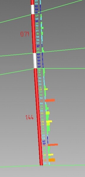
GEOVIA specialists have extensive experience in production sites, which allows them to accurately assess market needs and anticipate customer desires by offering additional features developed using proprietary algorithms. One of the most notable examples is the module for calculating weighted average planned distances and lift heights for transporting rock mass by types and directions. This module (Fig. 3) has proved to be sufficiently in demand and is currently being used with minor modifications at several enterprises. An additional convenience of the module, noted by users, is the ability to build longitudinal profiles of roads (Fig. 4) in accordance with construction norms and regulations, and to highlight problematic areas with excessive slopes in color. For GIS, this offering is currently unique.
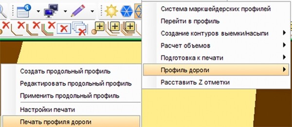
Distance Calculation Module Menu
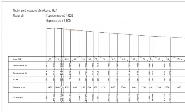
Road Longitudinal Profile
For geologists using the classical method of delineating ore intervals through intersections when estimating reserves, a specialized module has been developed that combines the use of an external geological database, a standard set of Surpac tools, and classic mathematical and logical expressions for delineating ore and non-ore intervals, recorded using TCL.
doesn’t stop at one thing, like Yandex.Metrica, but evolves and is used in an increasing number of different projects and industries. It can be expanded by adding new features to address new tasks. For instance, it is often believed that storing logs in a DB is outdated, which is why distinctively sets this package apart from competitive products.
Thanks to the ability to adapt the purchased software to their needs, the client can seamlessly integrate the new technology into existing processes at the enterprise.
Additionally, as a result of reducing the influence of human factors on the data processing process, the number of non-systematic errors is reduced to zero, ensuring confidence in the obtained results. The ability to formalize processes and outcomes allows for uniformity in input and output data.
In today's world, there is a growing demand for GIS, which allow solving complex interconnected tasks within a unified information space. This has been successfully implemented by the specialists of the Russian division of GEOVIA in the Surpac software through the development of embedded specialized applications.
Subscribe to Dassault Systèmes news and stay informed about innovations and modern technologies.
Source: habr.com
