

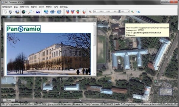
A stable release of SAS.Planet has been published — a program for working with maps and satellite imagery, supporting viewing, downloading, stitching, and exporting in various formats. It supports materials provided by services such as Google Earth, Google Maps, Bing Maps, DigitalGlobe, 'KOSMOSNIMKI', Yandex.Maps, Yahoo! Maps, VirtualEarth, Gurtam, OpenStreetMap, eAtlas, iPhone maps, General Staff maps, and more. All uploaded maps remain in the local system, and they can be viewed even without an internet connection. In addition to satellite maps, it is possible to work with political, landscape, combined maps, as well as maps of the Moon and Mars. The program is written in Pascal and is distributed under the GPLv3 license. The build is supported only for Windows, but fully functions under Wine.
In the new release:
- Route planning has been added using OSRM.
- Automatic line breaks in searches have been implemented.
- The 'Continue Route' function has been added.
- The 'Cancel Route Planning' function has been added.
- When displaying geographic coordinates, a point is used as a separator.
- The 'Manage Markers' window can now be closed by pressing the Esc key.
- Before exporting to Locus and RMaps, a check is implemented to ensure all parameters are correctly set.
Source: opennet.ru
